Documentation
Download Map Locations From Google Maps with MAP PUZZLE
If you want to download some map location from Google Maps, Bing Maps or any other map service, Map Puzzle is just what you need! It will allow you to save your map locations into high resolution images (jpg, gif, png, bmp, tiff)
The only thing you need to do is to enter GPS coordinates or address by GeoCoding, hit "Download" and you are done! The map has been saved into to your computer.
It works on Windows XP, Windows Vista, and Windows 7. Requires no installation and its FREE.
The name Map Puzzle is probably a bit misleading, it can make you believe that this is some kind of game. It came from the idea of putting together all those small map tiles into one large Map, a little bit like putting a puzzle :)
Getting started
-------------
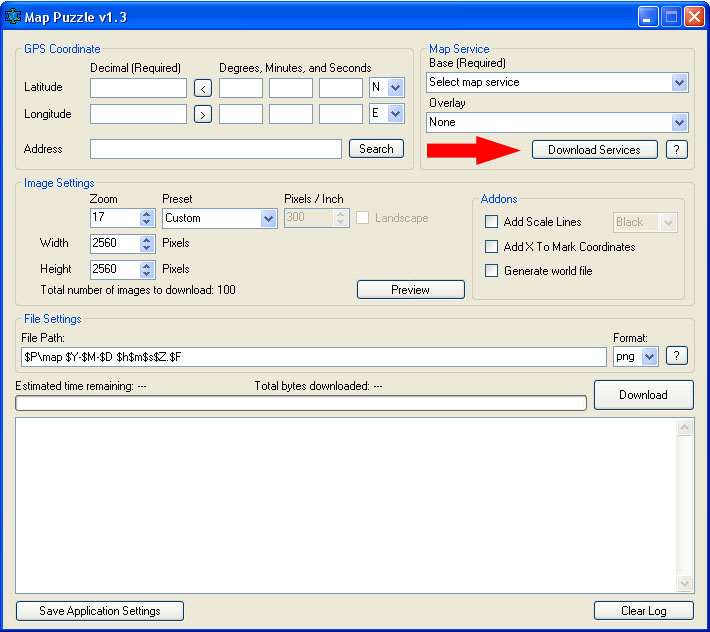
In the main interface you will see all the options. Get started by downloading the latest service list.
A file called mappuzzle-services.config will be created in the same folder that Map Puzzle is located in. How to edit this file you will find farther down on this page.
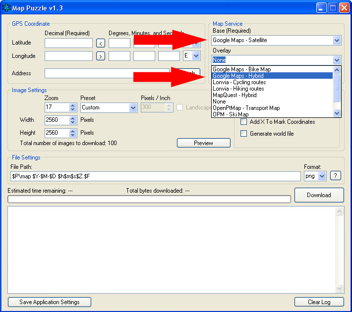
Then select the Map Service you want to use. Base layer is required.
The overlayer is a second layer that will be added upon the base layer, the overlayer can be transparent depending on the settings in the config file (mappuzzle-services.config), overlay is optional.
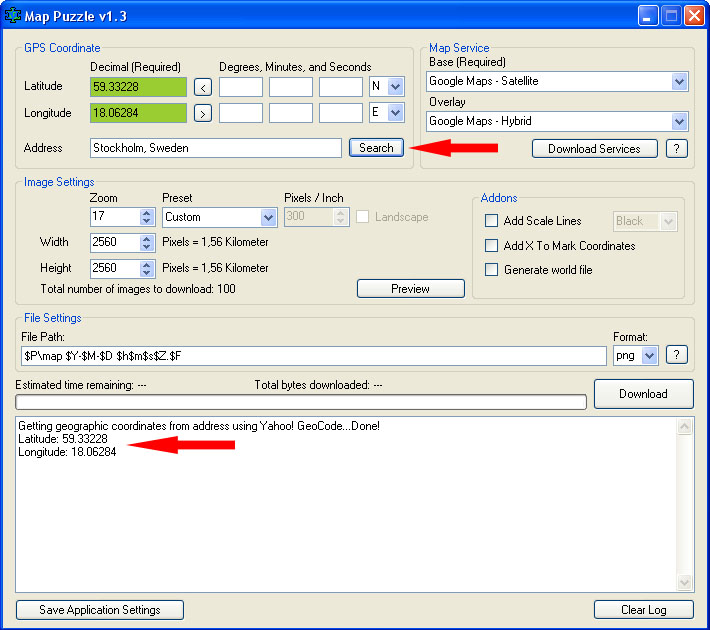
Enter GPS coordinates; fill both Latitude and Longitude of the map location you wish to download.
Or use the GeoCoding tool by entering a address and hit "Search"
Now select your preferred image settings.
If you are going to print out the map, you may want to use the preset sizes to most easily adapt it to desired paper size.
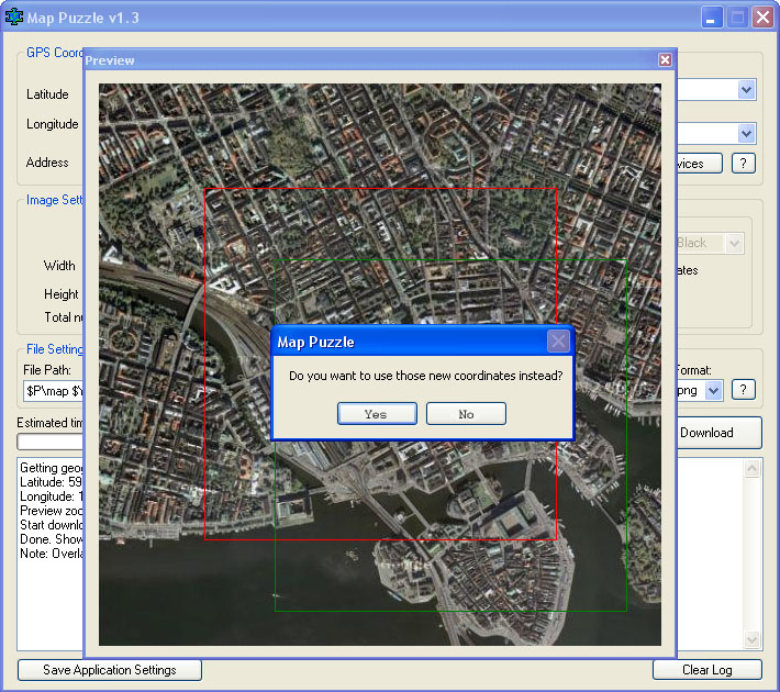
To make sure you got the right spot, use the Preview feature.
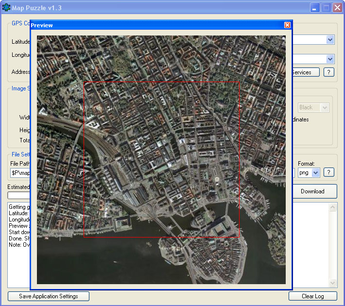
To fine tune the coordinates, hold down the left mouse button to move around the downloading area.
Double-click to confirm the new location.
The map moves in steps. Thats because each tile that is downloaded got the size of 256x256px.
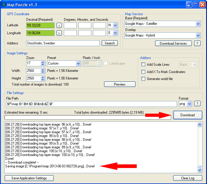
Once everything is filled. Then hit "Download" and Map Puzzle will start downloading all the tiles.
When the download is finished, it will save the map to the chosen file path. (To know what the different abbreviations stand for, press question mark in File Settings field)
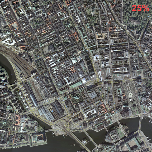
The downloaded map will look something like this. (The map is scaled down to 25%)
-------------
Addons:
* Add Scale Lines - This setting adds lines both horizontal and vertical, which shows the distance on the map to give you something to refer to.
* Add X To Mark Coordinates will add a red X mark on the exactly given GPS coordinates. The mark will NOT always be in the exact center of map since Map Puzzle is working with tiles. Each tile is 256x256px, so the mark will be somewhere within 256 pixels from the center.
* Generate World File is used by Geographic Information Systems (GIS) to georeference raster map image. Read more on Wikipedia
-------------
One of the new features that has been added in version 1.3 is the ability to edit and add new map services.
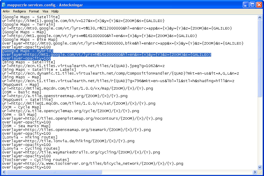
To edit the service list, locate the mappuzzle-services.config file in same folder as Map Puzzle and open it with Notepad.
The configuration file is divided into setting groups.
Each group presents a map service, starting with [name of service] and following settings.
First, determine whether there should be a base or an overlayer. You do this by either using the "url=" for base, or "overlay=" for overlayer, followed by URL to the map service. (You can use url and overlay in the same group)
The following features can be used in the URL to adapt it for the desired map service:
{X} = X coordinates from Longitude. Minimum X is Zero, Maximum X is 2^ZOOM level.
{Y} = Y coordinates from Latitude. Minimum Y is Zero, Maximum Y is 2^ZOOM level.
{ZOOM} = Zoom level.
{QUAD} = Quad key, which mainly used by Bing Maps instead of X, Y and ZOOM.
{GALILEO} = Used by google.
{1} = Are alternately 0 and 1. Can be useful for switching between two servers to distribute the load.
{2} = Same as {1} but 0, 1 and 2
$calc() = Is used to calculate easier math tasks. Example: $calc(3 * ({X} - 6)).
If the map service is a overlayer, you have possibility to set transparency, you just add the line "Overlay-opacity=50" and the overlayer will get opacity of 50%. If not set, the opacity is 100% by default. Base map does not have this option.
"min-zoom" and "max-zoom" is used to set the minimum and maximum zoom level provided by the service. (default min = 1, max = 25)
If you think something is missing in Map Puzzle. Please email me: